
Could Iran be using China’s highly accurate BeiDou navigation system?
Iran may be leveraging China’s BeiDou system to improve missile and drone targeting amid U.S. conflict. High-precision navigation from BeiDou could give Tehran an edge against GPS jamming and electronic warfare. Experts speculate Iran is integrating China’s satellite network to enhance operational accuracy in modern conflicts. The potential use of BeiDou signals a strategic shift in Iran’s approach to navigation and guidance systems. Tehran’s adoption of BeiDou could complicate U.S. and allied efforts to counter Iranian weapons.

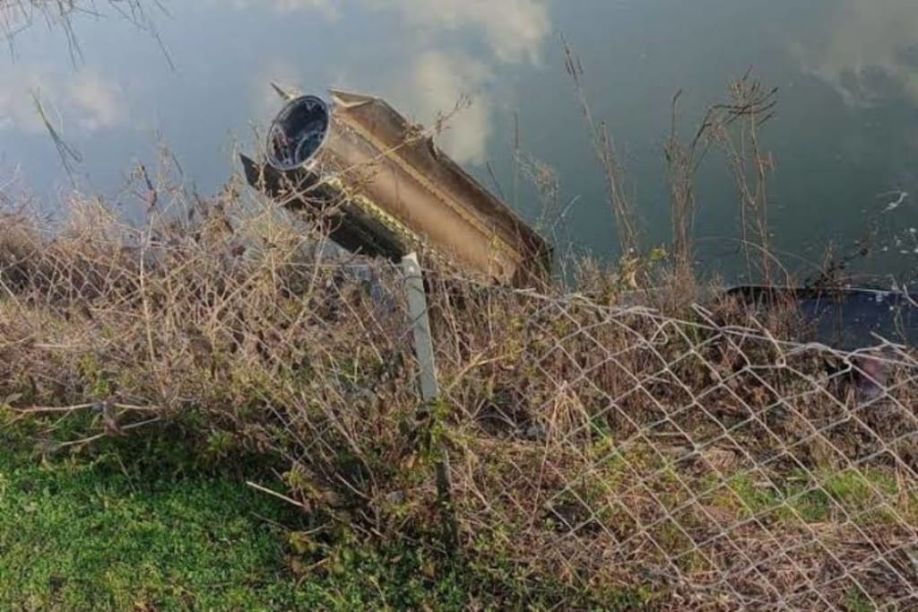
As the conflict between Iran and the United States and Israel continues to escalate, military analysts and intelligence experts are scrutinizing Tehran’s capabilities — particularly what might lie behind recent improvements in the accuracy of Iranian missiles and drones. One key question has emerged: Is Iran tapping into China’s BeiDou satellite navigation system to guide its weapons with greater precision? While Tehran has not officially confirmed such a move, multiple reports and expert assessments suggest it is a plausible explanation for shifts in Iran’s targeting effectiveness.
A Shift in Navigation Systems?
Historically, most militaries — including Iran’s — have relied on the U.S.‑operated GPS (Global Positioning System) for navigation and targeting. GPS has been the backbone of precision guidance for decades, underpinning everything from commercial aviation to missile delivery and drone flight control. But with rising political tensions and ongoing hostilities in the Middle East, Iran’s GPS‑dependent weaponry has sometimes struggled against sophisticated jamming and electronic warfare techniques.
Recent assessments from defense analysts point to a potential shift: Iran may be using China’s BeiDou Navigation Satellite System (BDS) as a strategic alternative or complement to GPS. Former intelligence officials note that the accuracy of Iranian missile targeting in recent months appears significantly improved compared to earlier conflicts, prompting questions about whether a more robust navigation source is in play.
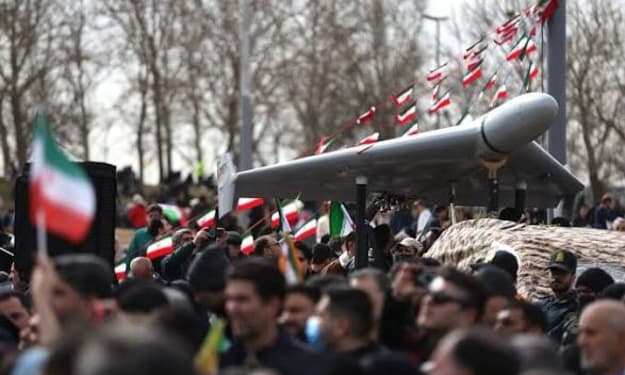
BeiDou — China’s global navigation network — offers several technical advantages that could explain this change. Its military‑grade B3A signal is designed to be resilient to jamming and spoofing, two techniques commonly used to interfere with GPS signals in conflict zones. BeiDou incorporates complex frequency hopping and authentication measures, making it difficult to disrupt with conventional electronic warfare. Experts say this could allow Iranian weapons to maintain course even under active jamming conditions.
Why BeiDou Matters
One of BeiDou’s standout features is its high accuracy and anti‑interference design. Unlike civilian GPS signals, which can be jammed or spoofed relatively easily, BeiDou’s military signals are engineered to resist such interference, providing a potential edge in contested environments. Military analysts report that BeiDou‑assisted guidance systems can achieve targeting accuracy within a few meters, a level of precision that significantly enhances missile effectiveness.
Another unique capability of BeiDou is its Short Message Communication (SMC) feature, which enables two‑way data links with devices equipped for the system. This means that a drone or guided missile could not only navigate using satellite positioning but might also receive in‑flight updates or commands even while far from its launch point — a capability that could substantially increase operational flexibility.
This combination of precision and resilience against jamming makes BeiDou attractive for militaries looking to operate in electronic warfare environments. And while internal Iranian statements have been limited, Tehran’s Information and Communications Technology officials have previously acknowledged the need to diversify navigation sources and reduce reliance on a single system after experiencing GPS disruptions in earlier conflicts.
Geopolitical Implications
The possibility of Iran accessing BeiDou has broader geopolitical implications. It indicates not just a technical shift in navigation architecture, but also a deeper strategic alignment between Tehran and Beijing. Iran’s interest in BeiDou is consistent with a broader desire for technological autonomy, reducing dependence on Western infrastructure that could be cut off or degraded during conflicts.
China has promoted BeiDou as a rival to GPS, and it has become widely adopted outside of China for civilian applications such as autonomous driving, ride‑hailing services, and logistics — highlighting its precision and reliability. While civilian use is separate from military access, the dual‑use nature of satellite positioning technology means that military forces in other countries can leverage the same system, provided they have compatible receivers.
Iran’s potential use of BeiDou also complicates the technological battlefield. Western and Israeli forces have invested heavily in electronic warfare to degrade Iranian guidance systems, but BeiDou’s design makes such efforts less effective. This, in turn, could force U.S. and allied militaries to rethink counter‑navigation strategies and invest in technologies that can operate effectively in the presence of rival satellite systems.
Remaining Questions and Transparency
Despite expert speculation, Iran has not officially confirmed it is actively operating using BeiDou, nor have Chinese authorities publicly stated they are providing direct access for military applications. Integrating a foreign GNSS (Global Navigation Satellite System) into missile and drone guidance is technically complex and often tightly controlled. Whether Iran has fully transitioned or is using a hybrid of GPS and BeiDou remains unclear.
Still, open‑source tracking of Iranian weapons and observed improvements in targeting precision align with what would be expected if BeiDou were in use — suggesting that at the very least, Tehran is experimenting with or has incorporated elements of the Chinese navigation network into its systems.
New Space Economy
Conclusion
The question of whether Iran could be using China’s BeiDou navigation system touches on technical, strategic and geopolitical dimensions. The strengths of BeiDou — accuracy, anti‑jamming features, and communications tools — make it a compelling alternative to GPS for nations operating in contested electronic environments. Even if official confirmation remains absent, the circumstantial evidence and expert analysis highlight the growing role of alternative satellite navigation systems in modern warfare — and how access to such technology can alter the dynamics of conflict.
About the Creator
Fiaz Ahmed
I am Fiaz Ahmed. I am a passionate writer. I love covering trending topics and breaking news. With a sharp eye for what’s happening around the world, and crafts timely and engaging stories that keep readers informed and updated.
Keep reading
More stories from Fiaz Ahmed and writers in The Swamp and other communities.
Iran’s Cheap, Plentiful Weaponry Puts US Military Under Unprecedented Strain
As the conflict between the United States and Iran extends into its second week, U.S. military leaders are confronting an unexpected strategic challenge: Tehran’s arsenal of inexpensive and abundant weapons is chewing through American defensive systems and munitions far faster than planners anticipated. What was expected to be a short, decisive campaign has evolved into a costly war of attrition, illustrating a growing vulnerability in America’s approach to modern warfare. The source of this strain lies in Iran’s reliance on large quantities of drones and ballistic missiles that cost tens of thousands of dollars to build, drastically cheaper than the sophisticated systems the U.S. military must expend to counter them. Iranian forces have launched thousands of such weapons across the Middle East, forcing U.S. forces and their allies to burn through expensive interceptors and defense munitions in order to protect bases, personnel, and infrastructure. Cheap Weapons, Expensive Defenses At the heart of the imbalance are systems like the Iranian Shahed‑series attack drones, which are relatively simple to manufacture — often costing roughly $20,000 to $50,000 each — yet have significant operational range and payload capability. These drones are difficult to detect due to their slow, low‑altitude flight profiles, increasing the burden on radar and air‑defense systems. Meanwhile, U.S. and allied forces often counter such threats with multi‑million‑dollar interceptors like Patriot and THAAD missiles, each costing millions of dollars per shot. This dynamic creates a classic “cost‑exchange ratio” problem: defence systems are repeatedly employed at far greater expense than the weapons they are trying to stop. In modern attrition warfare, this can bleed a technologically superior force dry, even if it remains tactically dominant. Analysts say that such imbalances can force operational and strategic shifts over time, especially when defense production and replenishment capabilities are stretched thin. Rapid Depletion of U.S. Munitions The scale of the consumption has alarmed lawmakers and defense experts alike. Pentagon estimates show that the United States expended around $5.6 billion worth of munitions in just the first 48 hours of military operations against Iran — a staggering figure that highlights how quickly stockpiles of advanced weapons are being consumed. This does not include the price of deploying airframes, vessels, or other high‑value platforms. On Capitol Hill, these figures have prompted urgent questioning about America’s industrial readiness and capacity to sustain a prolonged conflict. Some lawmakers worry that the Pentagon may soon have to request supplemental funding to build munitions at rates that current defence production lines cannot match, potentially diverting resources from other military obligations worldwide. Interceptor Burden and Strategic Stress The strain is felt most acutely in U.S. air and missile defense systems, which are being fired at Iranian drones and missiles almost continuously. While Patriot and THAAD batteries have helped protect personnel and facilities, their use comes at immense cost, and replacements are not instantly available. Even production of these sophisticated interceptors — requiring specialized components and industrial capacity — cannot be significantly accelerated overnight, leading to fears of gaps in defense if stockpiles fall too low. Defense officials have pushed back, insisting that current inventories are sufficient for ongoing operations. However, internal opposition and some closed‑door briefings suggest that confidence is not universal, as commanders must balance conserving interceptors with protecting forces in a fluid combat environment. Iran’s Strategy and U.S. Challenges Iran’s strategy appears to leverage exactly this imbalance. By launching large waves of inexpensive drones and missiles, Tehran forces the United States and its partners to expend far more costly defensive systems — effectively turning its own limited resources into a kind of asymmetric advantage. This mirrors broader trends in modern conflict, where less‑expensive drones and missile technology can impose outsized costs on more technologically advanced militaries. Compounding the problem is Iran’s ballistic missile arsenal, which has also been used to great effect, forcing U.S. and allied air defenses to remain constantly on alert. Intercepting ballistic threats often requires layered defenses, increasing the rate at which expensive interceptors are used. Broader Implications for U.S. Military Strategy The strain caused by Iran’s weaponry is forcing military planners to rethink traditional assumptions about high‑technology dominance. A conflict where quantity — not quality — dictates sustained engagement creates an environment where supply chain resilience, munitions production capacity, and industrial base flexibility become as important as battlefield prowess. Some analysts say the current conflict could be a case study for future confrontations, especially with other potential adversaries that have invested in inexpensive long‑range systems. The U.S. military may need to accelerate development of attritable or lower‑cost defensive systems and diversify supply chains to avoid strategic vulnerabilities. Conclusion: A New Kind of Warfare Iran’s use of cheap, plentiful weaponry has revealed a critical weakness in the U.S. military’s traditional approach to high‑end conflict: that superior firepower does not guarantee sustainability in the face of inexpensive, high‑volume threats. The strain on interceptors, the rapid depletion of munitions, and the rising cost of defense underscore a broader shift in the nature of warfare — one where economical mass deployment can challenge even the most advanced militaries. As the conflict continues, the Pentagon and Congress will be grappling with how to adapt strategy, sustain military readiness, and ensure long‑term defense industrial health in an era defined not just by technological superiority, but by the complex economics of war.
By Fiaz Ahmed about 4 hours ago in The Swamp
A Gathering of Evil Bosses
“I’m the queen of chin jutting while I smooth my hair, attacking, insulting, and deflecting to protect my appointer.” “Oh, please, Blondi, my hair is curled, highlighted, and longer than yours. I feature television commercials telling immigrants that we will give them a free plane ride home, and if they voluntarily turn themselves in, they will be allowed to legally apply for re-entry. It runs everywhere, and I look good in it! You can’t compete because of your blond hair. Mine is nicer, and my lips are prettier than yours.”
By Andrea Corwin 21 days ago in The Swamp


Comments
There are no comments for this story
Be the first to respond and start the conversation.